3 Days in the Peak District National Park
Travel Itinerary
Itinerary Contents
Itinerary Introduction
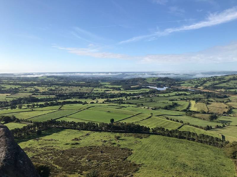
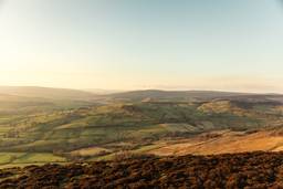
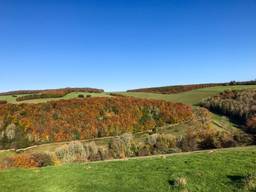
In the north of England lies the rolling hills and lush vales of the Peak District National Park. The landscape is split into the geologically distinct areas of the Dark Peak and the White Peak. The Dark Peak is dominated by moorland and grit sandstone whilst the White Peak forms sweeping limestone valleys and impressive gorges that have been eroded from the plateau. In both instances, the result is magnificent. Though not perhaps as dramatic as the likes of the Lake District or Snowdonia, the Peak District offers a slice of classic English countryside and is home to hundreds of excellent hiking trails. Since its inception in 1951 as the first National Park in England and Wales, it has long been a favourite of outdoor lovers and is widely considered to be a hill walker’s paradise. Perhaps the most famous of these trails is the Pennine Way, England’s first and oldest National Trails walking path. This epic 268-mile trail begins in the village of Edale, located in the middle of the Peak District, and makes its way north to the border with Scotland. Though this hike is of course too long to be walked in three days, you can get a sample of the trail by completing a shorter section during this itinerary. The landscape has a huge amount to offer, much of it being quintessential English countryside. Wild moorland plateaus drop into plunging valleys filled with a patchwork of sheep grazing fields. Grit escarpments and stony ridges flow into reservoirs and more bulging hills that hump into the distance.Useful information about the Peak District National Park
The history of the Peak District National Park
The Peak District is decorated with ancient history. The area shows signs of inhabitation back to the Mesolithic era. Settlers have roamed the land throughout the Neolithic period and agricultural practices were developed during the Bronze and Iron ages. The Peak District spans 555 square miles and is nestled between three great northern cities: Manchester, Sheffield, and Leeds. These settlements were particularly influential during the 19th century and spurred on the British Industrial Revolution. Today, these cities can be seen from the tips of the hills and their historic impact can be found throughout the Peak District in old mines, caverns, and mills.Best times to visit the Peak District National Park
The Peak District, like much of England, is subjected to a four-season weather pattern. Conditions are generally mild throughout the country but that doesn’t mean you can’t get more extreme and adverse weather conditions at certain times of the year. Most people choose to visit the Peak District in the summer. Calm, still days with lots of sun are what most hikers are looking for. However, this comes with some serious drawbacks. You will rarely, if ever, have the walking paths to yourself and will often find yourself jostling with other hikers on the summits. The car parks will fill up early and there will be traffic jams on the narrow country roads. The small towns and villages become thronged with people and lose some of their charm as holidaymakers spill out of the cafes and pubs into the surrounding streets. So, what is the alternative? If you are set on visiting in summer, aim for midweek and try to get up early when hiking. Avoid public holidays and weekends wherever possible. Fringe seasons of spring and autumn are another great option. Spring will also bring plenty of hikers but in a much more manageable load. Accommodation is easier to book and access to the car parks will be more feasible. Often, you can get days just as beautiful in the spring as you can in the summer. Autumn is perfect hiking weather. Crisp, frosty mornings and autumn-hued colours lining the hills and valleys. Good weather can spill into September and even October, so make sure you capitalise on the good days. Snow, although not common, isn’t unheard of in the Peak District. Short, dark days don’t make for the most pleasant hiking conditions and often the skies are grey and overcast. But if it’s isolation you’re after, then this is the season for you.Getting around in the Peak District National Park
For day trips, various parts of the Peak District are easily accessible. Trains run directly into Edale for those wishing to visit the Hope Valley. There is a line that cuts between Sheffield and Manchester with a few stops that allow access to the Peaks. You can also reach Buxton by train. Other public transport options include busses and taxis. Busses are limited in their use but can get you between the villages with relative ease. Taxis are expensive and not ideal for getting between remote areas. Ideally, you should drive when visiting the Peak District. It will allow you the most freedom when accessing the National Park and permits you to visit areas on your own schedule. As the Peak District is in the middle of northern England, it is surrounded by major cities linked to the rest of the country by a string of motorways. This makes it easy to access by car, although parking can be a problem. Try to leave early and plan ahead where you wish to park to make your life as easy as possible. If you don’t have access to a car, it’s highly recommended you hire one to make the most of your 3 days in the Peak District. Navigation While Hiking: - The hiking trails in the Peak District are well labelled and maintained. Signposts are used to direct you between the key features and you’ll likely find other walkers following the same paths as you. As the Peak District is relatively low in stature, 636 metres on Kinder Scout is the highest point, it’s often easy to see where you’re going. - The valleys drop away below, and you can make out the towns and villages you started from and the ridgelines you need to walk along. This of course assumes the weather is good. In the event of rain or cloud, the peaks can still be disorientating and carrying a map or GPS device with you provides that extra bit of navigational support if you don’t want to solely rely on signposting.Local cuisine in the Peak District National Park
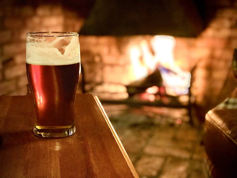
No trip to the Peak District would be complete without a trip to an English countryside pub. The villages and towns around the National Park are packed with excellent options. There’s something immensely satisfying about enjoying a local cask ale and a highly calorific meal, whilst surrounded by the natural landscape you’ve just conquered. A country pub and a jaunt in the hills, what could be more English?Where to stay in the Peak District National Park
Camping is the name of the game in the Peak District. Hillwalking and camping are so often synonymous with each other, and for good reason. The outdoor pursuits link in wonderful harmony allowing you to make the most of your time in nature. There are numerous campsites perched right at the base of the walking trails, though advanced booking is often required during high season. Wild camping, though not technically allowed in England and Wales, is often attempted in some of the more remote areas of the National Park. Generally, those who are discrete and pitch tents high on the peaks and away from any settlements have no trouble whatsoever. What could be better than watching the sunset from your tent with a warm cup of tea in hand? BnBs and guesthouses fill the villages and towns of the Peak District. The quaint settlements with Georgian stone buildings and old wooden beams make for a homely setting. Sitting by a cosy wood fire and looking out the window at the surrounding peaks is about as good as it gets. Edale, although small, has a few options. For more choice, aim for the towns of Castleton, Hope, Buxton, and Bakewell – to name a few. It all depends on how close you want to be to your hiking location. If you want to roll out of bed onto the hills, prioritise this when choosing where you want to stay.Alternative locations
- Bamford Edge & Stanage Edge - Dovedale - Chee Dale - Caving excursionsthe Peak District National Park - Travel Itinerary
Day 1
Ridge Hiking & Cave Exploring
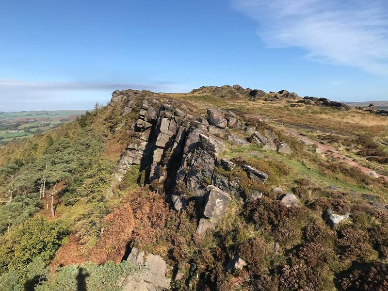
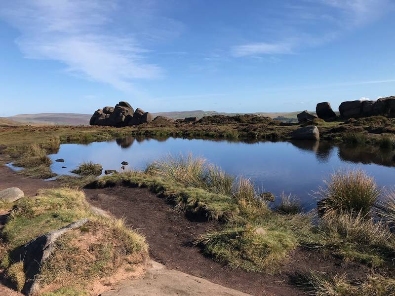
The Roaches
Notes
If rock climbing is for you, there are numerous 15 metre clefts to scale up. Alternatively, lots of climbers bring foam pads with them and do some bouldering on the lower rocks.
Getting there
There are two official car parks, one at Lud’s Church and the other at The Roaches. There are also areas of roadside parking but be aware, they are vigilant with dishing out parking tickets if you don’t abide by the rules. Like Mam Tor and Kinder Scout, this area fills up fast on sunny days. Make sure you get there early! The trail has no access by train and public transport is fairly limited. It’s possible to catch the number 16 bus that links Leek with Buxton and get off at Old Buxton Road. From here you must walk through Upper Holme to reach the base of The Roaches.
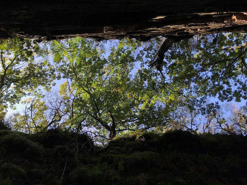
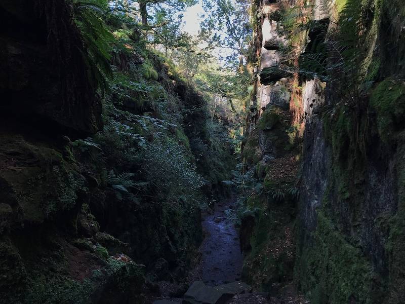
Lud's Church
Getting there
Lud's Church is part of the same area as the Roaches. Simply follow the signposts along the trail and you will find it!
The Lazy Trout Pub

Getting there
The Lazy Trout is a short drive from The Roaches UKC roadside parking.
Travel time
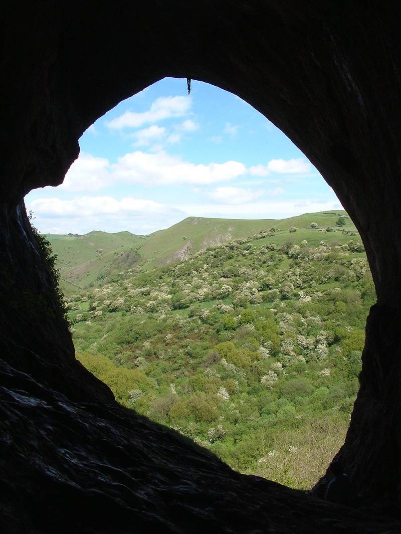
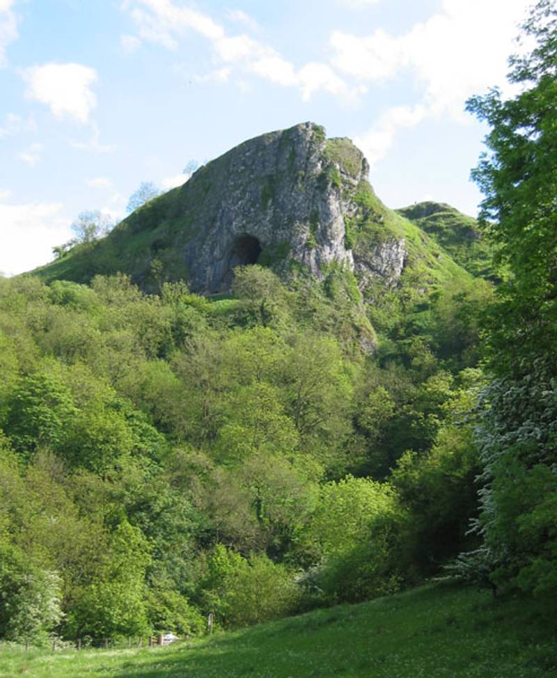
0 hours 10 minutesThor's Cave
Getting there
A short drive east will take you to the village of Wetton in the Staffordshire area of the Peak District. There's parking and toilets here to begin your walk.
Travel time
0 hours 25 minutesDay 2
Stately Homes & Tasty Treats
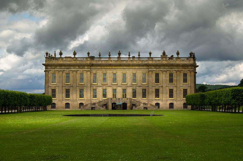
Chatsworth House
| Category | Price | Restrictions |
|---|---|---|
| Standard | 24.00 GBP | |
| Group | 12.20 GBP | |
| Kids | 12.50 GBP | Under 15 |
Getting there
Chatsworth House sits on the east of the National Park between Chesterfield and Bakewell.
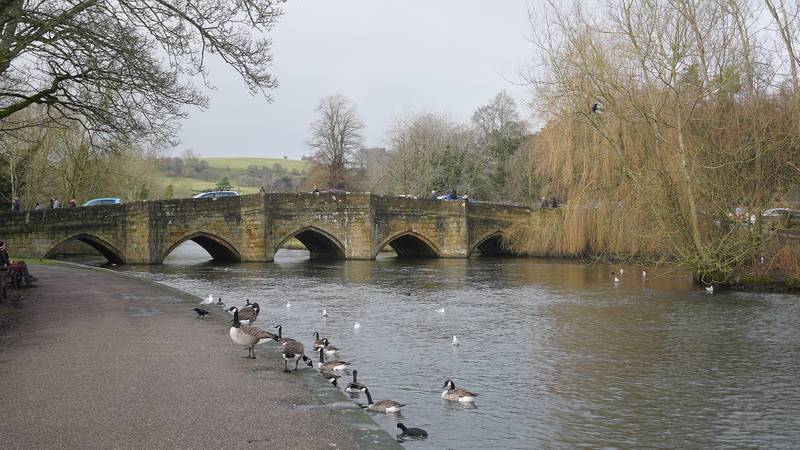
Bakewell
Notes
Take a stroll along the River Wye and amble around the market town. Be sure to visit Bakewell Bridge to admire the scenic stone arches.
Travel time
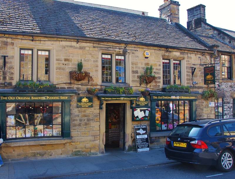
0 hours 15 minutesThe Old Original Bakewell Pudding Shop
Getting there
The Old Original Bakewell Pudding Shop is on the corner of Rutland Square and Anchor Square, close to the centre of town.
Travel time
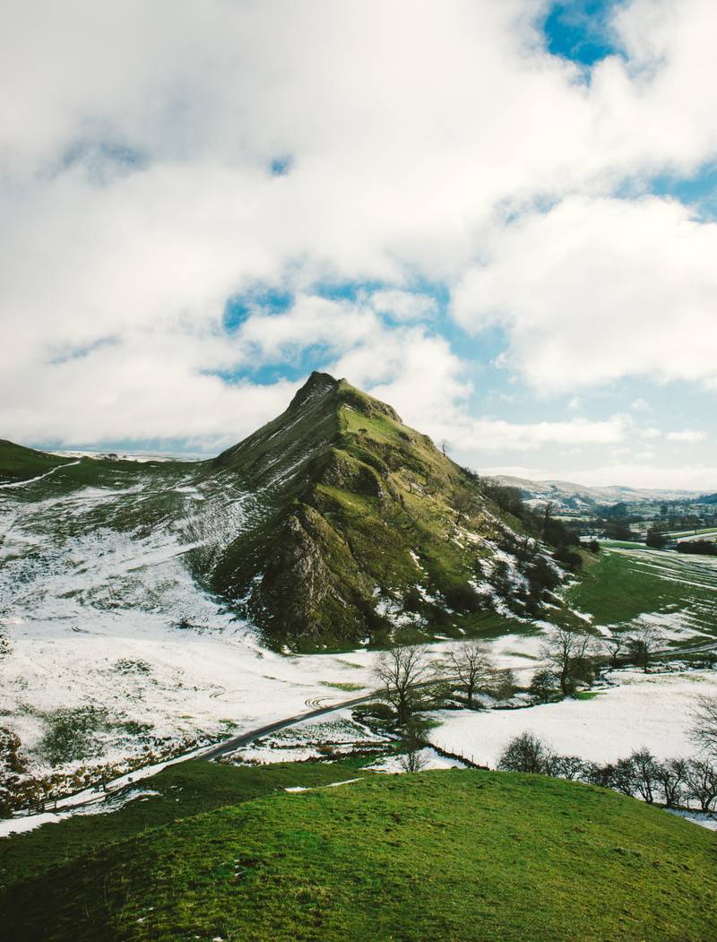
0 hours 5 minutesChrome Hill
Getting there
A bucolic drive should take you west, across the Peak Distrcit, to reach Chrome Hill in the afternoon. Enjoy the scenic views through the dales and over the fields.
Travel time
0 hours 30 minutesDay 3
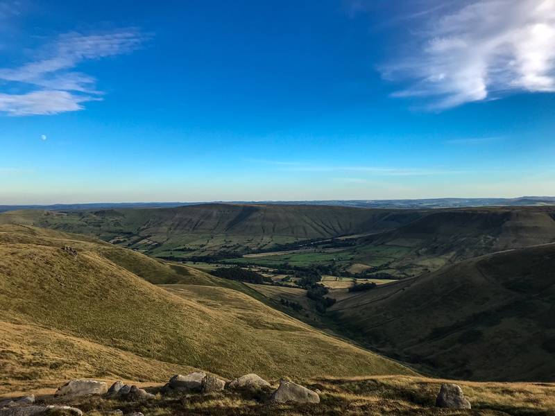
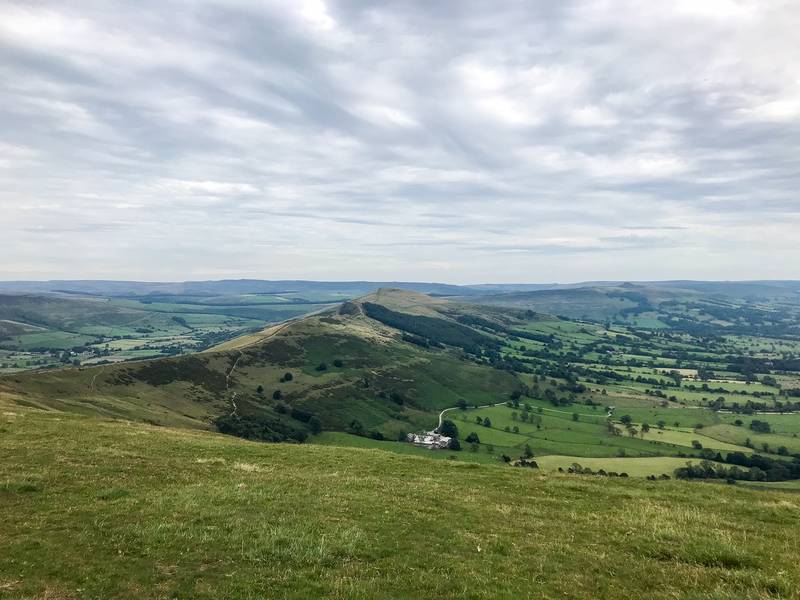
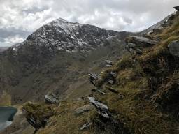
Kinder Scout & Mam Tor
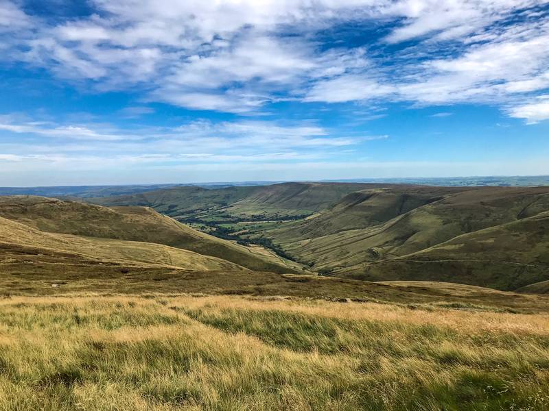
Kinder Scout
Notes
You can tackle Kinder Scout from a few different angles depending on what you want to see. Edale is the best position if you wish to include Mam Tor in your itinerary.
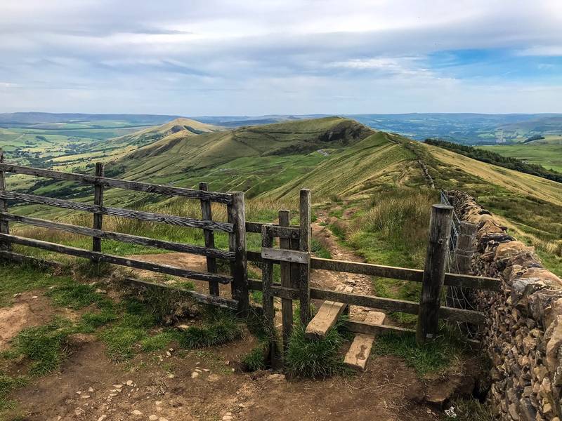
Mam Tor
Notes
Mam Tor can also be accessed from various loacations. If you start in Edale, you can walk round Kinder Scout, over Mam Tor, and back into Edale.
The Rambler Inn
Getting there
The Rambler Inn is on the northern side of Edale train station and car park.
Travel time
0 hours 10 minutesAbout the author
I have visited nearly 50 countries so far with some of my favourite destinations being: New Zealand, Norway, Japan, Mongolia, Iceland. I love hiking and all activities that involve exploring the outdoors. If you're interested in nature, walking, and adventures outdoors then you're going to enjoy my articles! Check out my website for some other travel blogs from around the world: https://mattwalkwild.com/ .
Reviews
Login to write a review
Related itineraries


Recommended itineraries